Illinois Crop Update 7/29/2022
Each week, I put out a request to crops educators and specialists from the University of Illinois to compile an update to share with the entire state. We hope you find this information useful. If you have any questions or suggestions about the format or any feedback in general about these updates, please email me (harbach2@illinois.edu).
Nick Seiter, Field Crops Entomology Extension Specialist, UIUC
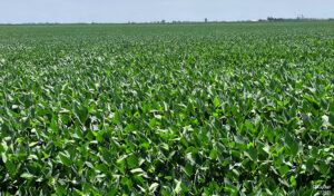
We picked up a report of spider mites getting started in east central Illinois this past week; this isn’t too surprising given the dry weather we’ve had. Consider scouting soybeans especially in areas that are currently under drought stress.
Trent Ford, Illinois State Climatologist
Our thoughts are with those in the St. Louis area who are recovering from flooding. A series of training thunderstorms moved over the St. Louis area on Tuesday morning, dropping up to 13 inches of rain in 6 to 8 hours, with the highest totals just northwest of the city. On our side of the river, Cahokia Heights, East St. Louis, and Belleville got the most rain, with 7-8 inches in about 6 hours. Just days before the flooding in St. Louis, parts of Lake and northern Cook counties picked up 5-6 inches in about 8 hours. The intense rainfall caused localized flooding in parts of Lake Bluff and Lake Forest. The intense events in northeast and southwest Illinois follow excessively heavy rainfall in Marion, Fayette, and Effingham Counties two weeks ago, harkening back to last year’s incredibly intense rainfall events in Gibson City and in Seneca, and in Bloomington-Normal… or to very heavy rainfall and damaging flooding in 2020 in Roanoke, Peoria, Chicago, Quincy, and Belleville in 2020. On the flip side, the area of moderate to severe drought in east-central Illinois continued to miss rain, with 7-day totals mostly less than half an inch. Parts of eastern Champaign County and western Vermilion County have had less than 40% of normal rainfall since early May, racking up an 8-9 inch deficit.
Temperatures were thankfully more moderate this week, ranging from the low 70s to low 80s. July will likely end right near normal in northern and central Illinois, and 1-2 degrees warmer than normal in southern Illinois. Looking ahead, and as always, there’s good news and bad news. The good news is that the forecast looks drier for most of the state next week, which folks in the St. Louis area will appreciate. But that also means areas already in drought – or on the verge of drought – won’t get much help as we move into August. Meanwhile, temperatures stay mild this weekend and are expected to increase substantially this next week. We’ll see highs in the low to mid 90s throughout the state all with very high humidity. Although the dry signal dampens a bit in the second week of August, well above normal temperatures are expected across the region at least through the first half of the month.
Phillip Alberti, Commercial Agriculture Extension Educator, Northern IL
Despite a dry June, July has been more accommodating for growth and development with more frequent accumulation. Both the corn (R1/R2) and soybean (R1/R2) crop look good/excellent as we head into August, depending on who you ask. Ariel-applied fungicides seem to be a common sight in Northern Illinois, although conditions have not been favorable for disease. Growers are encouraged to scout thoroughly and check forecasts prior to making fungicide applications to maximize efficacy. Taking action to protect a good crop is important, but timing is everything.
Doug Gucker, Local Foods Small Farms Extension Educator, East-Central IL
Our localized drought is persisting. It stretches from Vermilion & Edgar counties in the east to the east northeast up through McLean, Logan and back down to Macon county. Crops are still recovering in the evening from drought stress, which is good. Noting a few defoliators (loopers and Japanese beetles) in soybeans. With the dryness, corn leaf diseases have been slow to appear, but Physoderma Brown Spot is beginning to show up. Lots of fungicide is being aerially applied.

Nathan Johanning, Commercial Agriculture Extension Educator, Southwest IL
Most of our area now has gotten a break from the extreme dry conditions. Tuesday morning near Waterloo we had 1.6″ but only a 0.5″ further south in the county. At the same time, the St. Louis area and along the I-64 corridor in Illinois had record-breaking rainfall from 8 to 12″ within the morning. Thursday afternoon we also caught another 1.3″, but lesser amounts to the south. Some areas could use more but crops have recovered at least by appearance. Prior to this, corn, especially at few fields yet to tassel and some soybean field looked quite bad and showed major stress. Hopefully the rain with some moderated temperatures will relieve some of this stress for now!
Chelsea Harbach, Commercial Agriculture Extension Educator, Northwest IL
This past week was the third week of planes flying overhead, presumably applying fungicides. For what diseases, I know not. And as the forecast is shifting towards hot and dry again… I’m not so sure how useful any fungicide application is this growing season. This is why we recommend scouting for disease before deciding to spray instead of basing spray decisions on the sighting of other planes out flying. So I would say that going forward, diseases will likely not be anything of great concern. Without a doubt, there will be some incidence of diseases out there, but with the extended forecast, I’m not optimistic about how much disease severity we’ll actually see this year.


